Winter months in higher latitudes means lots of storms. The weather can change abruptly from cold and sunny to warm and raining. All this is brought about due to air-mass movement, and can be very unpredictable.
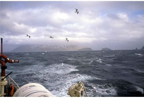
For those who have braved the oceans, the phenomenon of rough seas, sea storms, rogue waves and rip currents are not something unfamiliar. Any sailor who has ample sailing experience would have come across such a situation at one time or the other during their career. This article covers winter storms and frontal depressions and what role an air mass plays in these situations.
You might wonder whether there is any relevance of weather in the marine engineering channel, but for those who are new to navigation, let me tell you that weather is an important factors (as with the aviation industry) because even though modern ships are quite safe, extreme weather conditions need to be avoided to ensure the safety of the passengers, crew, and cargo.
Air Masses at Sea
A front is the boundary between the meeting of two air masses of different temperatures. One is a warm and moist tropical air mass while the other is a cold and dry polar air mass.
Due to the tilting of the earth on its axis the polar region (north or south of 67.5 degree latitude) gets less sunlight. Therefore the surface air in its contact is quite cold. Cold air cannot hold much water vapor, so it is dry and dense and has high pressure. The condition of the air mass is roughly uniform throughout the polar zone.
During winter months, the area falling in between latitude 40 degree to 67.5 degree gets cold. This means the air in contact becomes drier, colder, and denser. However this air is not as cold as in the polar zones and its spread is not uniform due to the presence of ocean and continental land masses. Air above cold continent becomes almost as cold as polar region, while the air over oceans is humid and warmer then polar air.
Tropical areas are roughly 90% ocean and 10% land mass. The air in contact is mostly warm, humid, and lighter, and normally has low pressure. Its spread is not uniform due to presence of huge continental mass of Africa, Central America, and the East Indies. In the case of the Atlantic and Pacific Ocean, its spread can be called almost uniform.
Due to various reasons, a surface air mass from a tropic area starts moving towards a pole. At the same time, a surface air mass from a temperate latitude starts moving or spreading southwards. Owing to the presence of large land masses in temperate zones, the movement is not uniform. The hot tropical air mass comes in contact with the cold air. Since the size of tropic air mass or maritime air mass has made inroads in the larger area of cold air mass in the temperate zone, it will appear as if the warm air is making a dent in the cold air.
Common Terms for Sea Weather
Stationary Front: Owing to different density and humidity, both air masses don’t mix readily. They lay side by side. This situation is called a front. Since the air masses are stationary, they are called a stationary front.
Warm Front: The warm air tries to replace the cold air due to its greater component of moisture.The leading edge of warm air mass is called a warm front. It generally moves from southwest to northeast. Normally warm air starts climbing above cold air in a gentle slop. There will be a rise in temperature and humidity after the passing of a warm front.
Cold Front: Due to greater density the cold air will start pushing the warm air from northwest to southeast direction in the northern hemisphere. The leading edge of cold air mass is called a cold front. The cold front undercuts the warm air in a steeper slope. At a given place the temperature may drop by 15 degrees C (59 F) after the passing of a cold front.
Depression: At the meeting point of warm and cold front, a depression is formed. When the cold front is forcing the warm tropical air mass upwards, it starts rotating anticlockwise in the northern hemisphere and forcing air to rise more rapidly, which reduces its pressure and a low or depression is formed. The air from high pressure comes to rapidly fill up the low pressure, causing a cyclonic storm to start. The wind force is inversely proportionate to the square of distance between the high and low pressure. The less the distance between high and low pressure, the stronger the wind force.
Occlusion: The cold air mass is cutting underneath warm air mass and is faster than the warm front; it ultimately lifts all the full warm air mass. This causes the both air masses to mix. Rising warm air ultimately cools at higher altitudes. The moisture condenses and falls as rain, releasing the energy required for a storm. When the complete warm front is lifted, it is called an occlusion.
References
- Photo by Angell Bob, U.S. Fish and Wildlife Service [Public domain], via Wikimedia Commons