Possession of land has been and even now is a very important part of the lives of everyone in this world. Irrespective of the fact surveying took place to find out which tribe possessed which forest or the limits of most important cities, the history of land surveying is amazingly fascinating.
What is Land Surveying?
The land surveying technique is the procedure of precisely finding out the earthly or three-dimensional space location of points and the distances and slants between them.
Definition of Land Surveying
According to the American Congress on Surveying and Mapping (ACSM), “land surveying is the science and art of making all essential measurements to determine the relative position of points and/or physical and cultural details above, on, or beneath the surface of the Earth, and to depict them in a usable form, or to establish the position of points and/or details.”
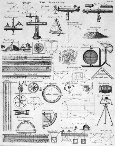
Image - Wikipedia Commons , Table of Surveying
History of Land Surveying
One of the first instances of a land survey applying mathematical methods was in ancient Egypt. The Great Pyramid which was constructed around 2700 BC at Giza establishes Egyptians’ awareness of surveying techniques. When the Nile River flooded the plains, the ancient Egyptians redrew frontier lines applying basic geometry. A register which dates back to 3000 BC can be found with the record of owners of different pieces of land and their locations. These surveys were established on geometry and uncomplicated declarations that they assumed these boundaries to be correct.
“Agrimensores” is the name of the land surveying taken up in the Roman Empire. This was actually done in the first century AD. In the 11th century England, William the Conqueror wrote a book known as ‘Domesday’ covering the names of all land owners, the quality and amount of land, and information on the people and resources in each area. Even Napoleon Bonaparte created a cadastre which is a register of property. This cadastre had used scale maps at both 1:2500 and 1:1250. As a result the present day Cadastral surveys had their origin there.
The present day surveys are much more precise than those done in decades ago and of course thanks to sophisticated means for evaluating and recording boundaries and land characteristics.
Land Surveying Techniques
The kinds of land survey technique chosen for use depend on a multiplicity of elements like the kind of survey that is being carried out. Land surveys are actually divided into three basic categories: standard land surveys used to fix property boundaries, compute land areas etc.; engineering surveys to assure that the building is built in correct place; and informational surveys which are applied to produce maps and charts. Yet another classification of land surveying technique is either geodetic surveys or plane surveys. Geodetic surveys are very accurate and address large areas by taking into consideration the curvature of the earth along with additional land survey techniques.
The five fundamental techniques are:
The triangulation land survey technique applies a sequence of linked triangles that unite and extend beyond each other, and from there slants can be evaluated from fixed stations. This is the most normally used land survey technique, which is also very well-organized since it reduces the count of measuring that should be made.
An electronic distance measuring tool which helps in measuring the dimensions of the triangles is used in the trilateration land surveying technique. It is from these measurements of the dimensions that the angles are computed. Trilateration is an ideal land survey technique in coarse land where it can be better off to get precise calculations than by means of the customary triangulation land survey technique.
Sequences of lines whose measured distance and dimensions are linked mutually by points in fixed locations are used in the traverse land survey technique. Traverse lines are either open or closed, and they are adjustable to move about rough terrain or obstructions as necessitated. This sort of land survey technique is generally used for producing preliminary surveys to build new roads.
The elevation in a particular area can be measured with the leveling land survey technique. This method involves determining the measurements of perpendicular distances on a calibrated rod by means of a leveling instrument. There are several leveling instruments, nevertheless dumpy levels, theodolites , and transits are the ideal options. The variation in the elevation between two points can be calculated with the help of trigonometry.
The last land surveying technique is radiation. The radiation land survey technique is utilized most regularly in combination with a plane table. By means of a fixed position above a ground position, a variety of points are assumed at the border of the survey area. These points are depicted on a piece of paper and the lengths evaluated and transformed to the requisite scale on the survey sheet. Radiation is generally applied with other land survey techniques like traverse and triangulation.
Conclusion and References
Land surveyors these days benefit from some of the most astonishing technologies. Our instruments for land surveying techniques are some of the most sophisticated and stimulating technologies in the world at present. Right from the EDM, 3D Laser Scanners, and GPS to the Lunar Laser Ranging and Very Long Baseline Interferometry the world of land surveying and geophysical science can express gratitude to Albert Einstein and his brilliance.
References
Johnson, Anthony, Solving Stonehenge: The New Key to an Ancient Enigma. (Thames & Hudson, 2008)
Keay J (2000), The Great Arc: The Dramatic Tale of How India was mapped and Everest was Named, Harper Collins, and 182pp
Pugh J C (1975), Surveying for Field Scientists, Methuen, 230pp