A cadastral survey of any piece of land would include complete details of the land, its dimensions, location, ownership, and cultivation. The survey serves as a complete land record that is a valid legal document. Such surveys have a long history and have been done for centuries.
Cadastral Surveying and Its Uses
The history of cadastral surveying and its relevance to civil engineering comes from the fact that it is civil engineers who are most qualified to conduct such surveys. Cadastral surveys are used to reestablish original land boundaries through the search for land titles or deeds, survey of marks on the ground, and any other public or private record that will verify the information gathered. A survey plan along with descriptions is then compiled and lodged with the Bureau of Land Management. Copies of these documents are given to the owner or person in whose name the deed is made and this serves as a record for legal claims in connection with the land. These documents are also used to maintain the details of the cultivation carried out on them and relate them to overall statistics gathered about the crops.
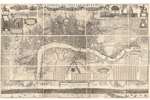
Image Source: Wikipedia: Survey of London by Wm Morgan 1682
How Did Cadastral Surveying Start
Cadastral surveying must have made a beginning when man first decided to settle in one place and become a food producer instead of leading a nomadic existence which needed him to hunt or forage for food. It is said that Ancient Egypt is where it all started, and there is evidence from tombs of that era that indicate the registration of land to provide proof of ownership. At this time a simple method of cadastral surveying was to set up boundaries of the land that was tilled.
These markers were quite often submerged during the annual rainy season when the rivers overflowed. They were then again set up with the help of references from permanent markers that were established above the flood line. The need for water to irrigate the fields led to most of these lands being along the banks of rivers and thus susceptible to floods. This method of maintaining public records about land, its use, and its ownership was established in those days, and such registration is in vogue even today. Some countries have a system where these records are maintained by private conveyancers and information from there is hard to come by.
How Cadastral Surveying is Conducted
Boundaries of land areas marked in cadastral surveys have always relied on two basic methods of demarcating them. One uses the presence of natural features like permanently flowing streams, well-grown trees, and hedges or stone walls that had been in existence for years. The other method is to create beacons or permanent markers made of stone. These markers are all referenced to each other and to other natural features to have a permanent record about the position. Where natural features are few and far between, straight lines between permanent markers are used as boundaries. The history of cadastral surveying and its relevance to civil engineering comes from the fact that it was this branch of engineering that was familiar with the techniques of survey , measurements and other plotting work needed to document such surveys.
The History of Cadastral Surveying
A land survey conducted in the Cape in Africa in 1657 used the river as one boundary and poles marked the other boundaries which were connected by straight lines between the poles. In Europe land and cadastral surveys used permanent structures and habitations as reference points for the corners. The use of theodolites and other surveying instruments started in the middle of the nineteenth century and by then it had also become compulsory for every land record and sale of land to be properly surveyed and registered. Ordnance surveys were first conducted in the 1700’s mainly for establishing military roads. The year 1785 saw the establishment of the Public Land Surveys System after the United States received international recognition. The year 1813 saw cultivable lands being added to such surveys so that taxes could be imposed on the land owner.
Modern Methods for Cadastral Surveys
The Global Positioning system or GPS was established by the Defense department that allowed positions to be given in real time with accuracies of 5 to 20 mm. This is done by sending signals to satellites in space and receiving signals which are then further processed to give the position of the point receiving the signals. GPS surveying techniques are used by cadastral surveyors to enhance traditional techniques of surveying. Satellite mapping is increasingly being used by land management authorities to get real time information on land usage and changes which then have to be again corroborated by cadastral surveyors.
References
Cadastral Surveying - https://csg.dla.gov.za/cadsurv1.htm
GPS for cadastral survey - https://www.gmat.unsw.edu.au/snap/publications/roberts_2005a.pdf