The role of a surveyor is now extremely significant. A growing number of disciplines including mapping, navigation, and Global Positioning Systems concern the modern surveyor. Advanced surveying techniques are more accurate, faster, and reliable than traditional methods, with new technologies emergi
What Is Surveying
In the broadest sense, surveying is gathering information about a topic. With regard to geography, surveying is the field of gathering information about land- such as boundaries, areas and elevations-using geometric measurements. Surveying is typically in reference to earth landforms and structures, but is also valid for lunar surfaces and other terrestrial planets.
Surveying is an essential science for the fields of design and construction. Boundary surveys apprise people regarding the geographical location and limits of their property, and title surveys are an important part of the real estate business. Land topography maps are required for the preparation of detailed engineering designs. The plotting of river foundations is necessary for dredging. Delineation of corridors through survey techniques precedes the construction of roads, tunnels, airports, and pipelines.
History of Surveying

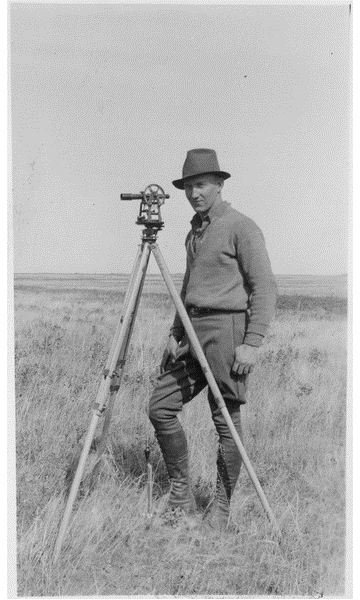
Surveying has been an important factor in human civilization since ancient history. The surveyors of ancient Egypt, also called “rope stretchers,” measured distances by using ropes at appropriate intervals. They also made measurements with chains with standard length links, pulled firmly to minimize slack. Compasses that provided the deflection measurements measured angles. These survey instruments improved over time by incorporating accurately engraved discs with improved angular resolution.
Surveying was also important in Greece. As the Greeks explored the science of geometry, they put it into practice to divide land precisely. The Greeks also developed the first surveying instrument, called a Diopter.
During the industrial revolution, the development of roads, railroads, and canals demanded more precise surveying techniques and surveying technologies advanced. This era saw the development of geodetic and plane surveying.
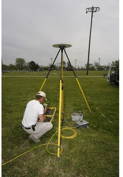
Modern surveying techniques- Global Positioning Systems, Geomatics, Geodesy and Remote Sensing-have replaced the older surveying techniques. Today, surveying has many purposes. In addition to establishing boundaries between plots of land, it is necessary for mapping the globe, both above and below sea level, and devising land, air- and water navigation routes. It is also necessary for gathering engineering data for constructing roads, bridges, and buildings. Surveying is also essential for acquiring databases for natural resources management.
Geomatics
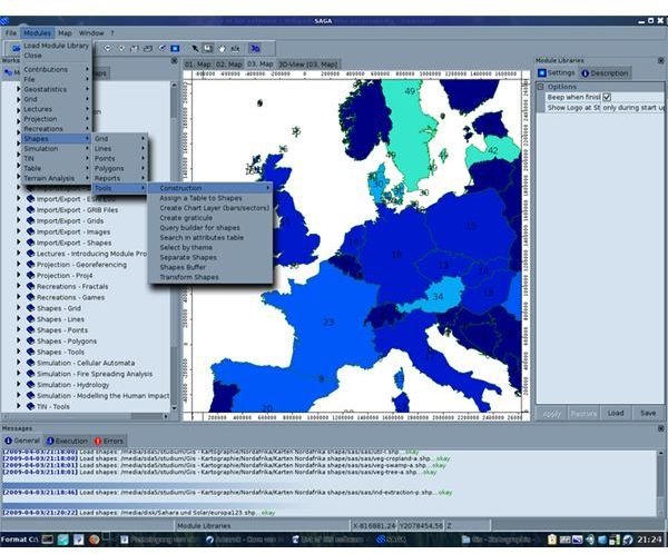
Geomatics has redefined the surveying technology of the last quarter of the twentieth century, and it is still undergoing revolutionary progress. This science encompasses a large variety of earth mapping techniques, including Global Navigation Satellite Systems, remote sensing, and photogrammetry. Geomatics is a progressive field that integrates acquirement, modeling, study and managing of data. It uses global, maritime, aerial and satellite based sensors to obtain data. It then transforms the data obtained from different resources into selected information systems. The associated field of hydrogeomatics involves geomatics for surveying on, below, or above the sea surface or other water bodies.
The fast progression and extensive operation of geomatics is due to the advancement in computer technology, software engineering, and computer science. Space sensing technologies have also contributed immensely in the growth of geomatics. Several universities have gone so far as to replace the names of their survey departments with geomatics or geomatic engineering.
The major disciplines of geomatics include:
- Mapping
- Navigation
- Geodesy
- Remote Sensing
- Global Positioning System
- Photogrammetry
- Airborne Laser Scanning
- Geospatial
- Digital Terrain Modeling
- Hydrography
Future of Surveying
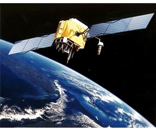
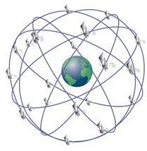
With advancements in technology, new surveying equipment and techniques are developing. Current advancements are making the science of surveying more valuable, accurate, and comprehensive than ever. For example, the use of GPS in modern surveying methods is one of the radical changes influencing land measurements. GPS is a breakthrough technology in surveying because it is extremely precise, fast, and reliable.
Furthermore, the role of the surveyor is changing as technology expands and geospatial data becomes available to anyone through programs such as Google Earth. A surveyor is no longer necessary for many basic data acquisition tasks … because the data already exists. Instead, the modern surveyor needs skills in geospatial data management and analysis.
Challenges for the Future Surveyor
The technical boundaries of the surveying in history are no longer applicable. With current technologies, measurements and estimation have become easy. Subjects of rising significance are the formation and managing of data and, subsequently, data application. The contemporary surveyor’s challenges include the induction of modern dominant technologies such as airborne scanning, terrestrial scanning, satellites that create high-resolution images, and an increasing number of satellites.
As surveyors continue to work, they work with an increasingly diverse collection of professionals. The state and private sector is recognizing the economic significance of this discipline and that it has huge future growth prospects. It is an exciting time for the discipline, and surveyors have to adapt themselves rapidly to the latest technologies if they wish to remain valuable in the field of surveying.
References
- Image 3: Wikimedia Commons, Surveying Equipment .
- Image 4: Wikimedia Commons, “Configuration of GPS Satelites ”
- Image 5: Wikimedia Commons, Artists rendering of a GPS Satellite , NASA
- Image 6: Wikimedia Commons, Saga GIS Screenshot
- Image 1: Wikimedia Commons, “The Surveyo r”
- Image 2: Wikimedia Commons, “Surveying wheel and chains ,” Sixteenth century playing cards showing surveying equipment.
- The History of Surveying , Purdue Engineering
- Surveying: A Profession and Career Choice , Penn State University
- The New Surveyor - Geospatial Wise and Technology Savvy . Directions Magazine. Joe Francica. Tuesday, November 27th 2007.