Dam break simulations are now assisted by computer analysis, but the difficulties in correctly estimating dam break roughness caused by uncertainty in the configuration of downstream areas that can get inundated or flooded continue to make the simulation an uncertain exercise.
The need for dam break simulations
Dams are built across perennial rivers for the purposes of creating a water supply source, to create head for the production of power , for flood control and lastly for irrigation. Dams are a form of interference in the natural topography of the land and due to the huge amounts of water that do get stored, any break in a dam can cause floods and widespread destruction in the path of the water flow. Dam breaks have not been unknown, some caused by extreme weather conditions, earthquakes, by poor engineering during construction and others due to circumstances not envisaged during the construction of the dam and the reservoir that has been created. Terrorist activity is one scenario that is also being kept in mind while working out such simulations. Engineers have therefore made a simulated dam break a part of any dam construction so that the concerned authorities can have emergency measures planned out to deal with such a disaster. Dam break roughness and the difficulty of having definite estimates of downstream channel areas and their constantly changing conditions makes dam break simulation very much of an uncertain affair.
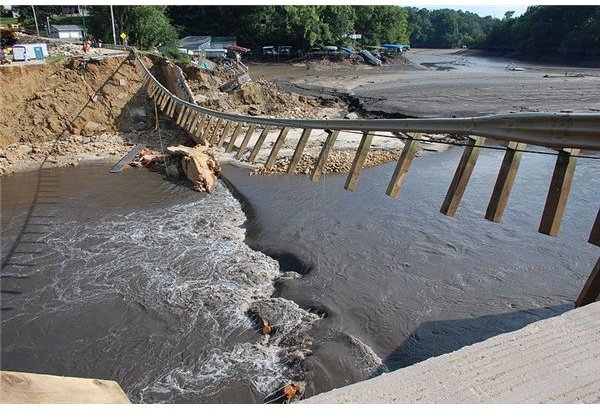
Image Source: Wikimedia : Damage caused by dam break
Flow in open channels created by dam breaks
Flow in any open channel which will be the condition of overflow from any dam break is normally calculated by the formula Q=A*V, where Q is the flow rate, A is the area of the open channel and V the velocity of the water. The problem in a dam break simulation is to calculate the value of V which is influenced by the slope or hydraulic head loss, the hydraulic radius and a coefficient which is the Manning coefficient which indicates the friction created by the water flow. This is easily determined while the flow is through built up channels, but becomes difficult to determine when the flow is through an earthen channel especially if it has vegetation. Again the hydraulic radius is a factor that depends on the area of the water flow divided by the wetted perimeter. This again is very difficult to determine in the case of an earthen channel whose shape and wetted perimeter would keep constantly changing as the flow proceeds along the channel and also because the shape of the channel and other factors that influence flow will keep changing in flood situations caused by the dam break. Roughness in deciding the Manning’s coefficient makes estimation of flows difficult.
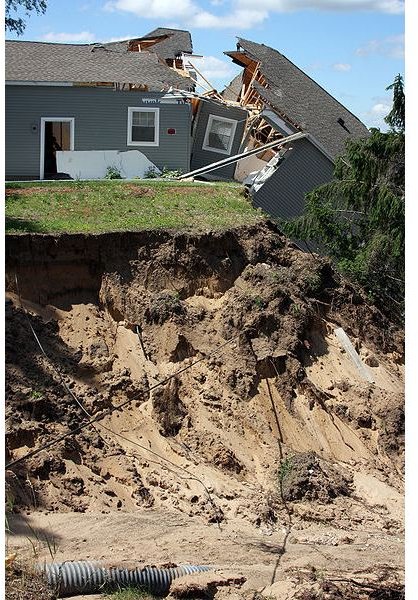
Image Source: Wikimedia : Damage
Dam break scenarios
A dam break is likely to lead to inundation of areas adjacent to the dam, and this is the emergency situation that has to be assessed for mitigation purposes. It is likely to lead to high water levels for areas downstream where the flood waters get contained by existing banks or dikes, but can still cause disruption of life. It can cause damage to bridges or other structures in the channel that will carry the flood waters. All these can be roughly assessed by having topographic maps of the areas which will allow engineers to estimate the area that can be flooded in the immediate vicinity of the dam, calculate water levels in the water channel further downstream, the length of the channel that will get affected and the time which it will take for water levels to recede to safe levels. While assessing dam break scenarios the continued inflow into the reservoir has also to be part of the calculations especially if extreme weather conditions are part of the picture.