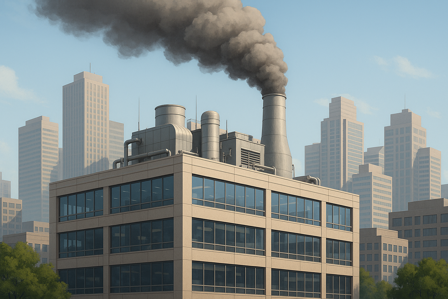
Spatial awareness of evapotranspiration of the land surface and moisture in the soil at the root zone is of primary interest for environmental applications like maximizing irrigation water utilization and crop water insufficiency in dry and semiarid structures.
What is Evapotranspiration?
Evapotranspiration (ET) is a term which describes the process by which plants liberate water vapor from inside the plant when its stomata opens and closes. Evapotranspiration takes place inside plants to adjust the temperature of leaves and keep them from attaining exceptionally high temperatures.
According to Parlange et al “Modeling, mapping and monitoring, of actual evapotranspiration (ETa) and soil moisture from farm to catchment scale is vital knowledge for water resources management. ET and soil moisture are multifaceted functions that depend upon soil properties, climatic conditions, land use, vegetation, and topography which cause these parameters to vary in both space and time. Therefore, it is difficult to estimate or representatively measure these parameters at the regional scale.”
Conventionally, ET has been figured by multiplying a weather-established orientation ET by crop constants (_K_c), found out based on the crop type and the crop development stage. On the other hand, surface opposition can differ according to the day and the climate conditions, particularly due to existing radiation and low vapor pressure.
The finding of crop coefficients is also controversial for several reasons. The evaluation of whether crops grown with the surroundings are accurately determine by the Kc measures is a question, particularly in scant water areas. In the same way, the different approaches used to measure soil moisture capacity, which range from the quantity of earth-based soil dampness to models based on remote sensing and land surface models, may not adequately reflect local conditions.
Satellite remote sensing is a dominant source to calculate approximately Actual Evapotranspiration (ETa) and soil moisture extent over a range of earthly and spatial scales, which runs from individual picture elements to a whole raster picture that may cover an entire river basin. These techniques are well known since 1990 because of the lower costs involved in collecting data, which is for instance $0.03/ha for irrigated lands.
Methods for Calculating ET
Different techniques have been formulated to calculate approximately evapotranspiration and soil moisture by aggregating satellite images and ground meteoric data for big areas, from experimental processes like simplified correlation to multifaceted, multi-discipline methods established for remote sensing data incorporation along with Soil Vegetation and ATmosphere (SVAT) models.
Techniques for calculating ET can normally be sorted into three classes; direct measurement, the energy balance or micrometeorological method, and experimental methods based on a combination of energy balance or climatic factors. The majority of these techniques can merely render point estimations of ET which are not adequate for system-level water management.
Over the last two to three decades, noteworthy development has been made to calculate actual evapotranspiration (_ET_a) with the help of satellite remote sensing. These means provide ways to calculate _ET_a from the level of an individual pixel right up to an entire raster image.
The Surface Energy Balance Algorithm for Land (SEBAL) method calculates a total radiation and energy balance along with resistances for thrust, heat, and water vapour transfer for each picture element. The fundamental participation data for SEBAL comprises spectral radiance in the noticeable, near-infrared radiation and thermo-infrared portions of the spectrum. The custom weather data arguments like the wind velocity, moisture, solar radiation, and air temperature are required along with the satellite images. Evaporation is computed from the on-the-spot evaporative fraction and the everyday mean final radiation. The evaporative fraction is calculated from the instant surface energy stability at satellite overpass on a pixel-by-pixel footing.
Elements Affecting Evapotranspiration
Since the rate of a plant’s transpiration depends on several factors as part of the hydrologic cycle, evapotranspiration follows suit. Air temperature is the most important factor since an increase in the temperature of the air raises the amount of transpiration as well. When warmer air encircles plants, their stomata open up and more transpiration takes place. The opposite, a lesser rate of transpiration, occurs when the temperature is cooler. Since evapotranspiration is the summation of transpiration and evaporation, when transpiration lessens, so too does evapotranspiration.
The next factor on which evapotranspiration depends is the amount of water vapor in the air. As air saturates more and more, less water evaporates into the air. Consequently, as the proportional humidity steps up, transpiration decreases.
Movement of wind and air transversely over an area is the third factor which affects evapotranspiration rates. When the movement of air increases, evaporation and transpiration also increase since moving air is less concentrated than stagnant air. Once inundated air moves through, it is replaced by drier, less concentrated air which can then take up water vapor.
The moisture existing in a plant’s soil is the fourth factor which affects evapotranspiration since when soil lacks moisture, plants start to transpire less water in order to survive. This consecutively diminishes evapotranspiration.
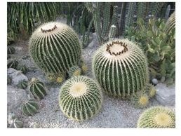
The ultimate factor which affects evapotranspiration depends on the kind of plant involved in the transpiration procedure. Different plants transpirate water at different rates. For example, a cactus is contrived to preserve water. Per se, its rate of transpiration is less than that of a pine tree. The reason is that the pine does not require preserving water as their needles also permit water droplets to collect on them and be later lost to evaporation, besides the usual transpiration.
ET Lesser in Cactus Zone
Conclusion and References
Thus the mapping of evapotranspiration using space based techniques has a bundle of potentiality. Research should also be undertaken to test microwave devices that are not touched on by clouds. Presentations to prospective end users establishing the power of appraising land from space are necessary to show the supremacy of surveying from space and to let remote sensing move from being a dedicated research tool to become a key asset for mapping evapotranspiration and the betterment of much-needed agriculture.
References
Allen, R., Pereira, L. S., Raes, D. and Smith, M. (1998), Crop evapotranspiration. Guidelines for computing crop water requirements. FAO Irrigation and Drainage Paper, 56.
Bastiaanssen WGM (1995), Regionalization of surface flux densities and moisture indicators in composite terrain, a remote sensing approach under clear skies in Mediterranean climates. Report 109, Agricultural Research Department, Wageningen, the Netherlands.
Chemin Y and Alexandridis T (2001), Using remote sensing for deriving water productivity indicators in low data environments. A case study for different irrigation unit sizes in Zhanghe Irrigation District, China.
Parlange, M. B., (1995), Regional scale evaporation and the atmosphere boundary layer, Reviews of Geophysics, 33, 99-124.