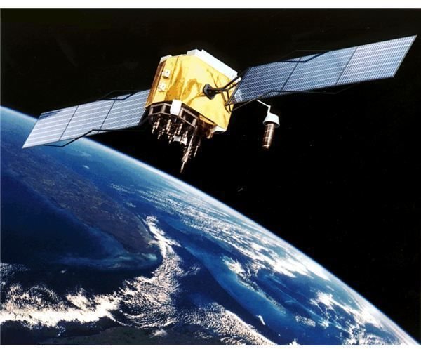
The GPS basically consists of the orbiting satellites, earth control stations, and the receivers. The GPS signal has enormous important data that is used for several purposes including survey. The user position is also established from the GPS signal.
Basics of GPS Surveying
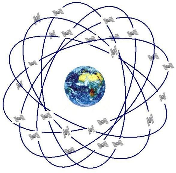
The Global Positioning System is essentially a navigation system that is based on satellites network using very accurate atomic clocks. GPS was initially planned for military use, but later it was also available for the civilian use. GPS operates globally in all weather conditions. The satellites move around the earth in an extremely accurate path, and data is transmitted to the earth receivers by signals. Triangulation is used by the receivers to determine the precise user location. The receiver carries out a comparison of the signal transmission time, and the signal reception time. The difference in time indicates the distance of the satellite from the receiver. Such measurements taken from a number of satellites indicate the user exact location that is used for GPS land survey. A minimum of three such measurements are essential to determine the longitude and the latitude of the user position. The user altitude can be evaluated if measurements are taken from four or more satellites. The GPS can also determine the bearing, speed, trip distance, and many additional data required for the GPS survey techniques. GPS survey instruments are widely used for GPS land survey, the making of maps, and other surveying requirements.
GPS Receiver Clock Correction
One of the foremost errors in the GPS data is regarding the GPS receiver clock. Since the light speed is enormous, the distance estimation from the satellites to the GPS receiver is effected by any errors in the GPS receiver clock. Therefore, an exceptionally precise clock is vital for the GPS receiver. A technique to cater for this issue has been introduced that determines the intersection of spheres. The clock error is established by evaluating the valid distance estimate from the receiver to the satellites.
GPS Signal Inaccuracies
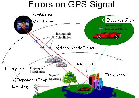
The GPS signal may become inaccurate due to several reasons:
- Delays are caused due to the troposphere and the ionosphere. The speed of satellite signal is reduced as it travels in the atmosphere. The GPS can calculate this delay, and correct this error partially.
- The signal may have multiple paths. This can occur when the signal is reflected from objects like large rocks or high buildings before reaching the receiver. Thus, the signal travel time is increased, causing errors in the estimates.
- The receiver clock may have errors, since these clocks are not as precise compared to the atomic clocks located on the satellites.
- The satellite orbit may not be determined precisely, due to which errors may occur.
- The number of satellites that are visible to the receiver will increase the signal accuracy. Buildings, geographical features, and electronic interference may decrease the signal quality, causing signal errors. Due to these reasons, the GPS performance decreases when working indoors, undersea, or underground.
- The position of satellite influences the signal accuracy. The satellites are positioned ideally when their location angles are wide. The signal errors are extreme when the satellite locations are in one line, or grouped tightly.
GPS Signal
A GPS signal has various information, including ephemeris data, pseudorandom code, and almanac data. Ephemeris data is transmitted continuously by the satellites. It contains significant information regarding the satellite status, indicating its health, and the time and date. This signal component is crucial for establishing a position. The pseudorandom code is basically an identification code that distinguishes the transmitting satellite. The almanac data illustrates the satellite orbital information.