Surveying is an important discipline in civil engineering that is intimately associated with a large number of facilities, including railways, roads, dams, bridges, and residential areas. Surveying creates the legal geographical boundaries and provides data for computer databases.
What Is Surveying
Surveying is the technique of determining the three dim
ensional positions of points, including the distances and angles between these points that are normally located on the surface of the earth, but may also be located above or beneath the surface. Surveys are conducted for the preparation of maps, plots, topography, and boundaries to establish ownership of land, and used in the design, planning, and construction of any type of structure and communication networks. Knowledge of geometry, mathematics, and law is applied in the field of surveying. High accuracy optical and electromechanical equipment, including global positioning data obtained from the satellites, is also used for surveying.
History Of Surveying
Surveying is an important constituent that has been involved in the growth of the h
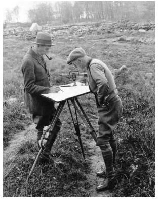
uman environment since the ancient era. In prehistoric Egypt, when the boundaries of farms were washed out due to the overflow of the River Nile, the surveyors restored the boundaries by the use of geometry. The perfect north and south direction, and the accurate shape of a square of the pyramid of Giza, confirm the existence of the science of surveying in the period of 2700 BC. The corners of the pyramids of Egypt were set by surveyors utilizing surveying tools and fundamental principles of mathematics. The land surveyors existed as a profession during the era of Romans, and they formed the measurement system, for geographical identification of the sub-divisions of the Roman Empire.
Types Of Surveys And Their Application
The surveys generally conducted are as mentioned below:
Geological Surveying: It is a survey conducted for recording the geological important features of th
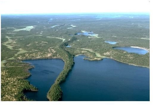
e area under study. Data is obtained from satellite or aerial photography for several purposes, such as geochemical or geomagnetic topics.
Construction Surveying: It is used to mark the positions and layout of structures, such as buildings and roads for subsequent construction.
Topographic Survey: It is a survey that determines the elevation of different points located on some piece of land, and marks them as contour lines on a plot.
Hydrographic Survey: It is a survey carried out for the purpose of mapping the coastline for the purposes of navigation or resource management purposes.
Deformation Survey: It is a survey to establish if an object or structure is moving or changing shape. It is conducted by determining the three dimensional positions of particular points, and the measurements are repeated after the passage of some period of time, at the same points. Comparison of the two sets of readings indicates if there is any movement taking place, or a change in shape has occurred.
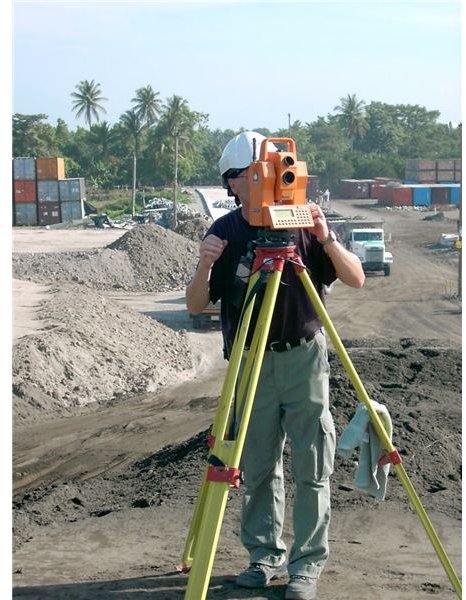
Modern Surveying
Surveying is undergoing a radical p
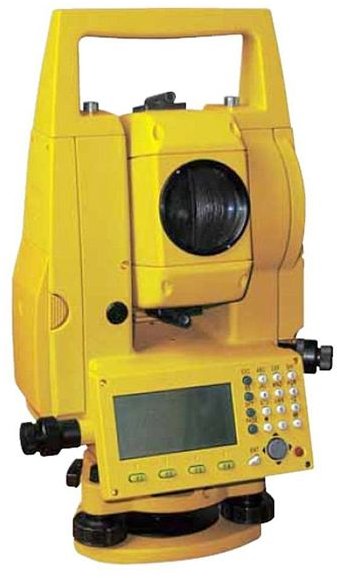
hase keeping in view the modern techniques being utilized for the measurement, recording, storage, and retrieval of data. This has been possible because of the rapid advancements in the computer and other technologies. Consequently, reliability and accuracy of the data has increased considerably. Modern total stations are being used for surveying that are fully robotic and efficient. A total station is an electronic instrument used for the measurement of distances and angles from the device to the points being surveyed. By the use of trigonometry, the measured angles and distances are utilized to determine the real location of the points that are being surveyed. It has now become essential that topographical maps be developed with larger scales, including the creation of digital maps for improved planning. There is a requirement to augment our efforts in the measurement and supervision of global changes caused by nature or the human beings.