How to Read a Land Survey Plat
Introduction
A land survey plat is used for representing map characteristics of the land, and their relative position as well. Different measuring techniques and tools are used to represent the measurement of the land on a paper. In simple terms, a land survey plat is responsible for showing a map in which the whole measurement of a land is described so as to simplify other important tasks.
These surveys are of different types and depict different information, such as American Land Title Association (ALTA) surveys that represent property lines, improvements, easements and utilities. Furthermore, boundary line surveys are responsible for showing property lines and corners, and are used to obtain building permits.
You will require few things for performing this job, and these things are land survey plate, magnifying glass, ruler, copy of land transfer document, and title insurance policy.
Here are some points that show the importance of land survey plat, and also the way to read the information provided on it. This will help you to understand various legal rights to the land as well.
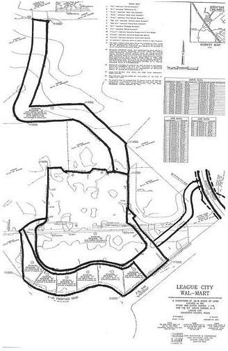
Plat of Survey Example
Review Land Transfer Document and Title Insurance Policy
This is very essential point during the study of land survey plate: these documents are responsible for all the legal description of the land. You should check any third party involvement in the land. Review the documents so that to avoid any problems in the future.
It also essential to read about the surrounding land represented in the survey plate. Land survey plats show adjacent land and its utilities and easements. They also have importance and affect legal rights to the focused land.
Use the Survey Legend
The next step is to find the survey legend. Different symbols are used in survey plats to indicate the elements of the land such as corners, water, streets, vegetation, etc. The survey legend is required to understand these symbols so as to read the survey plat easily.
Understand the Scale Ratio
Understanding the scaling used in the survey plate is very important. You will find it in the survey plat. This scale shows the ratio between the distance in survey plat and the distance of actual land. You should use a ruler to get the right information of the distances or parameters of the land.
Find Out the Type of the Survey
Secondly, you should check the type of the survey. it is required to identify which type of information you will get by a particular survey plate. You can find the type in the title of the survey. The information about the type of the survey is also available in the surveyor’s certification.
You will also need to find out whether the survey plat is described by subdivision lots or by metes and bounds. If the land is divided into subdivisions, the whole procedure becomes simple. Actually, if it is subdivided, then you can identify and read each part with the help of lot numbers provided for each subdivision. If it is described by metes and bounds, then you have to figure out the beginning point to understand the lengths, degree angles, and curves.
If Land is based on Metes and Bounds
If the land is described by metes and bounds, then find out the beginning point. Actually, this point represents the location of the point, from where the land legally begins.
Afterward, start the study using legal description provided with the document of transfer or title insurance policy. Keep in mind one thing: if the survey plat is described by metes and bounds, the legal description will end at the point from where it starts, i.e., the end point and the beginning point on the survey plat will be same with respect to the legal description.
Now, the procedure is divided into two different types.
If Land is divided into Subdivisions
If the land is subdivided, you have to look at each boundary line and also the land around it. This is to identify any borderline easements that may have been developed when subdividing the plat.
You will need to locate some important points present on the survey plat. These points are as follows:
- Locate all easements, utilities, and other indications, which are indicating any unpleasant property rights in the land.
- Locate any improvements regarding the land and adjoining land as well. It’s also important to locate the distance between the improvements and boundaries and every easement.
- Locate natural situations on the land. The natural situation involves natural things such as water, minerals, and vegetation. This is because the natural situation may affect construction and improvements.
References
Reference-www.tpub.com
Reference-ehow.com
Reference-mff.dsisd.net
Image-plat of survey example- flikr.com-Brave New Films